Coming Soon: New Gazebo In Bordentown, NJ – Bring Your Waders
This is not a flood – it’s a high tide
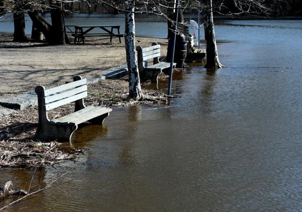
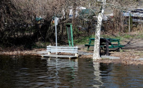
This is NOT a flood, or even a full moon high tide . The new Gazebo will be built just to the left of the first bench. The full moon high tide brings water about 300 feet inland, behind the benches, inundating the new gazebo site.
Sometimes politicians do stuff that is so incredibly stupid, that I can’t let it pass un-noticed. This is one of those times.
Just for fun, let’s call it “Gazebo-scam”. Check it out.
I walk my dog along “Bordentown Beach” every day, where I pick up all sorts of plastic crap that the tide washed in.
But on Wednesday morning, I was confronted with something different – I noticed survey stakes and marked trees very close to the water.
Uh oh, were these idiots planning on removing even more riparian vegetation than the last fiasco?
Previously, they removed about an acre of natural vegetation along Blacks Creek and planted grass. The land is under water during high tide, often has standing water, is so muddy that it is unusable, and now must be maintained/mowed. Take a look at the before and after conditions:

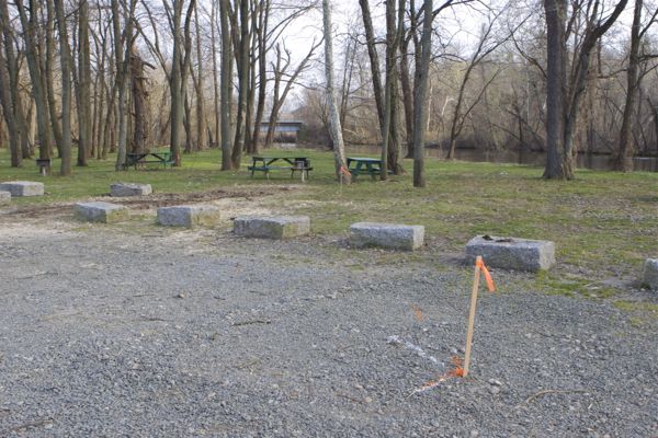
riparian vegetation along Blacks Creek was destroyed and grass planted. This land is under water on full moon high tide.
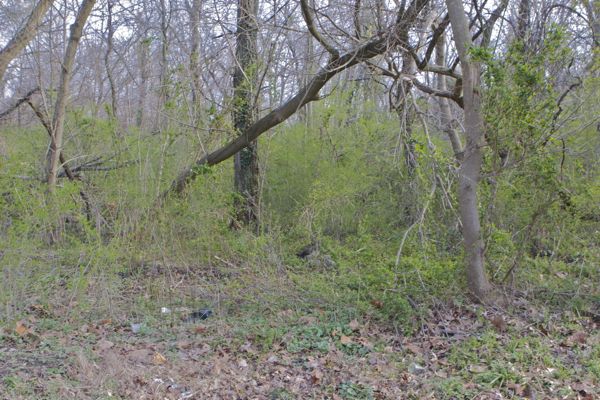
Here’s what that riparian vegetation in the park along Blacks Creek looked like before they cleared it out and made lawn:
Yesterday morning, at 8 am there was a tree crew there and trees already were cut down (did the DEP permit allow this??).
Members of the forestry crew were taking a break, so I had an opportunity to ask a few questions.
I was told that they had to do this for free in exchange for parking their trucks at the Bordentown City’s water tower site. How’s that for a quid pro quo?
They also told me that DEP had been to the site and forced the City to back the Gazebo away from where it was originally planned, to at least 50 feet from high tide (assume this was stream encroachment permit staff).
So the initial location was even worse – on a tiny point of land at the confluence of Blacks Creek and the Delaware River.
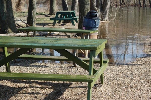
I told the crew that I didn’t know how DEP measured the high tide, but that the picnic table they were sitting at – which was a good 150 feet further inland away from the water than the gazebo site – was under water on a full moon high tide.
Take a look at the site of Bordentown’s new Gazebo – I have no idea who is responsible for this and frankly, I may not even waste the time to find out:
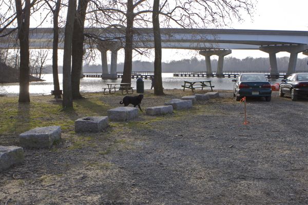
Location of new Gazebo – at full moon high tide, this spot is under water. I 295 one rDelaware river in background
All of the land you see here is underwater during routine full moon high tides – maybe 6 or more tides over 3 days per month.
If we can’t educate about the value of riparian vegetation, the risks of sea level rise and end the practice of DEP and local governments approving stupid development in public parks, where can we?
See more of this park: