DEP Dodges Role of Climate Change In Sandy and Sea Level Rise
DEP Bows To Gov.’s Political Views
DEP Fails to State the Science on Climate Change, Sea Level Rise, and Flood Maps

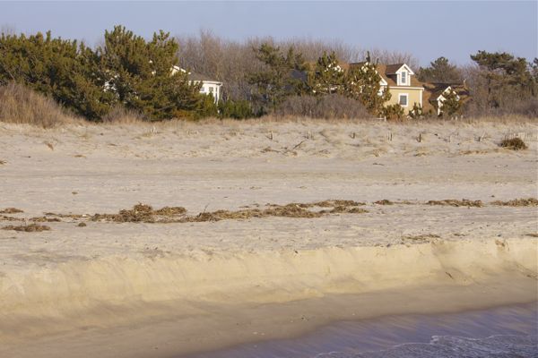
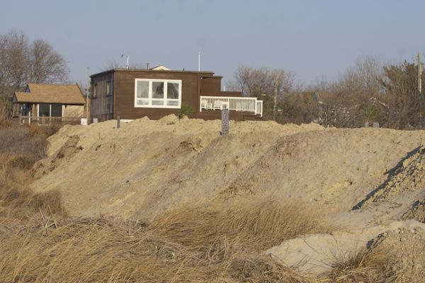
homes at Cape May Point - The end of the line - no where to run, no where to hide, from sea level rise and climate change
Yesterday, DEP adopted the FEMA Draft Advisory Base Flood Elevation Maps (read the DEP press release and the DEP response to comment adoption document).
In doing so, as is legally required, DEP responded to all public comments on the rule proposal.
In an extraordinary and deeply troubling move, DEP failed to accurately state the well known and consensus scientific relationships betweeen climate change and sea level rise.
DEP scientists and engineers know that climate change is causing sea level rise. Recent maps on sea level rise were released by Rutgers University, further validating that consensus scientific view (see: Sea level map offers disturbing picture of Shore’s future) .
Yet the DEP experts were gagged from stating that scientific fact in a regulatory document (just as we warned, see):
- Rutgers Sea Level Rise Maps Being Ignored by DEP
- NEW JERSEY YET TO COME TO GRIPS WITH POST-SANDY FLOOD RISKS – Coastal Maps Do Not Account for Climate Change Effects; Inland Maps Decades Old
This is even more troubling because the issue was raised point blank in public comments (mine #51, #52), which obligated the DEP to respond accurately and comprehensively to that issue. DEP chose not to do so.
This further politicizes the issue and is evidence of direct Christie Gov. Office influence on DEP experts, who obviously blocked DEP experts from accurately responding –
Here is the public comment and the evasive DEP non-response.
51. COMMENT: Climate change is real. As the planet and the ocean warms, the ocean expands, glaciers and arctic ice melts. That increases the volume of the ocean and that results in sea level rise. It’s going to happen at a more accelerated rate in the future. We have to plan for that and we have to adapt to that. Climate change also causes more extreme weather events due to the warming of the ocean and warm moisture in the atmosphere. Testimony about Superstorm Sandy being a 500 or 700 year storm cannot be scientifically credible or statistically valid.
- COMMENT: In January of 2012, before Superstorm Sandy hit, FEMA adopted a climate change adaptation policy that explicitly called for future risk to be incorporated in the FEMA programs, including projected conditions. That represented a significant change in FEMA policy because FEMA had previously dealt with historical data and not projected conditions. However, FEMA’s ABFEs do not comply with FEMA’s own policy because they reflect historic conditions and do not project forward.
RESPONSE TO COMMENTS 47 THROUGH 53: The Department recognizes that the extent of flooding within the State can increase over time due to a variety of factors. In response to this, the Flood Hazard Area Control Act rules were amended in 2007 to require that the lowest floor of buildings and the elevation of many roadways and parking areas be situated at least one foot above the flood hazard area design flood elevation. The Department also regulates a flood larger than the 100-year flood in fluvial areas to account for possible uture changes in flood elevations. This rulemaking incorporates additional amendments that ensure construction activities in New Jersey will utilize the most recent and accurate flood mapping available. The use of FEMA’s ABFEs and automatic incorporation of effective FEMA maps that depict the Department’s flood hazard area design flood elevation ensure that the State will not rely on outdated or inaccurate flood mapping. Furthermore, should FEMA incorporate additional risk factors into its depiction of the 100-year flood elevation on its Flood Insurance Rate Maps, these changes will be automatically incorporated into the Department’s delineations. As the Flood Hazard Area Control Act rules are set to expire on November 7, 2014, the Department will again have an opportunity to review the best available data and risk indicators and determine if additional rule amendments are necessary.”
One of the “ variety of factors” DEP recognized is climate change and sea level rise.
My comment specifically noted defects in DEP’s rule specifically with respect to climate change.
DEP chose not to respond to the comment and that could only be because it would embarrass the Gov. and DEP’s failure to consider climate change in Sandy response.
[ps – note one coastal group (e.g. COA, ALS) or planning group (NJF) submitted comments on the DEP rule. Delaware Riverkeeper, Sierra Club, and PEER were the only environmental groups to participate.]


