Archive

Archive for June, 2017

Greetings From The Top Of The Rockies

June 27th, 2017 No comments

Independence Pass – 12,095 feet

view from Independence Pass

view from Independence Pass

We had another incredible day –

The day began as we broke camp along Chalk Creek at the base of Mt. Princeton (in the San Isabel National Forest just south of a trailhead for Colorado Trail, which we walked for only a few miles)

Mt. Princeton shrouded in clouds

Mt. Princeton shrouded in clouds

Chalk Creek roars by our campsite

Chalk Creek roars by our campsite

and ended camped off a National Forest Service road above Turquoise Lake just outside Leadville Colorado:

check out the view from our "dispersed campsite"

check out the view from our “dispersed campsite”

_DSC3431

Leadville is a hardscrabble old mining town, but it is surrounded by incredible beauty.

Too bad the federal money (and Big Ag corporate subsidies) spent by the Bureau of Reclamation building dams, fake lakes (reservoirs) and other absurd irrigation and boondoggle water infrastructure couldn’t instead be spent on improving the lives of the mostly poor people who live there.

We’re in Boulder today, waiting for our bike to arrive and be re-assembled at the local bike shop.

Take a look at one of our better days (and I left out the reservoir we swam in and a lovely stroll through Twin Lakes):

_DSC3424

_DSC3416 (1)

more from the top of Independence Pass

more from the top of Independence Pass

headwater stream of the Arkansas River, draining Mt. Ebert

headwater stream of the Arkansas River, draining Mt. Ebert

_DSC3402

_DSC3421

we stealthed just off a forest service road. Had to negotiate with a nearly homeowner. Chalk Cliffs in background.

we stealthed just off a forest service road. Had to negotiate with a nearly homeowner. Chalk Cliffs in background.

Boie on guard - waiting for nightfall and coyote's.

Boie on guard – waiting for nightfall and coyote’s. He managed to worm his way into and slept in the tent with me!

Categories: Uncategorized Tags:

Oh Be Joyful – Crested Butte, Colorado

June 22nd, 2017 No comments

_DSC3357

Above is the view I woke to this morning. Low light sunrise.

Oh Be Joyful!

_DSC3337

Seriously, that’s the name of the trail I camped at last night.

_DSC3350

Here’s more from gorgeous Crested Butte, a very upscale tourist but still rugged old mining town (great biking and hiking and fishing and all sorts of outdoor activities!):

_DSC3329

Apologies to anyone still reading that I’m so far behind in posting about places we’ve seen along the way. The weather and landscape have been just so spectacular that I’ve had little interest in going inside and writing. Plus, there is very little shade and difficult find a spot to park for a few hours to keep the van cool with Boie inside.

For weeks now – not in any systematic way – we’ve been following rivers towards their mountain sources – Rio Grande, Dolores, San Miguel – and now the Gunnison River.

Now that we’re out of the harsh desert southwest, we’re crawling up the spine of the Rockies now. Here’s a few of the places we’ve enjoyed in the last few weeks:

Black Canyon National Park: (off the SOB Draw Trail)

_DSC3309

same shot, different foreground:

_DSC3318Boie’s lair:

_DSC3314

Just off BCNP North Rim – cattle drive (how the West was lost):

_DSC3234

Sunrise on the San Juan’s, from Hermit’s Rest – Curecanti National Recreation Area:

_DSC3217

San Juan’s, from Ridgway, Colorado (a great little town!)

_DSC3147

The San Juan’s from a lovely park in the center of Ridgway, Colorado: (classic western movies like True Grit and How the West Was Won were shot here):

_DSC3143

Apologies for the low quality photos, I sold my Canon camera and L lenses and am using a small Sony A6000.

All for now. Enjoy.

Categories: Uncategorized Tags:

Sixty On The San Miguel

June 12th, 2017 No comments

A Legal Rocky Mountain High

_DSC3130

After Friday night camped along the South Fork, we spent Saturday, my 60th birthday, further north along the San Miguel River.  The river is flowing high and fast, after a winter with twice the average snowpack in the San Juan mountains. I had to keep Boie away because he would have been swept away. (photo above – interestingly, that posting on the tree on the left was not put there by Colorado Fish & Game – it was a “placer claim”. The same couple had posted the river downstream for over a mile.)

Before leaving town on Friday to avoid the weekend and upcoming bluegrass festival crowds, we stopped in at Telluride’s “Green Room” – “a recreational and medical marijuana dispensary” – to procure a 1 gram vial of legalized weed (about 4 buds) and get a Rocky Mountain High in the San Juan Mountains. It was quite an experience – although about 5 times more costly than the dope I smoked in college, it was far more potent.

As we left town, we noticed that the South Fork was running very muddy, so drove up a forest service road to try to locate what must have been a major landslide or washout of some sort – take a look how muddy the river was:

_DSC3110

Compare that with a clear flowing tributary (look closely to see it flow into the brown muddy South Fork):

_DSC3113

Drove maybe 10 miles upstream, but source of the problem was further upstream.

We expect to ramble around Colorado west of the great Divide for the month of June, before heading north to Montana and Glacier National Park.

We’ll keep you posted.

Categories: Uncategorized Tags:

Toxic Telluride

June 9th, 2017 No comments

Heavy metals in paradise are poisoning children

Main Street, Telluride Colorado (looking east)

Main Street, Telluride Colorado (looking east)

Telluride, Colorado

Looks beautiful doesn’t it?

As I hiked in, I saw an old mining building:

former Idarado Mining Company site

former Idarado Mining Company site

Looking more closely, I came across the sign about a reclamation permit (no mention of remediation):

_DSC3106

Then I saw these impoundments – no fences and no warning signs – and immediately put the dog on the leash to keep him out of them:

_DSC3088

As I hiked up the mountain switchbacks – breathing dust from the ORV crowd – I worried about the dog drinking the water.

As I suspected, according to the Colorado Department of Public Health & Environment its toxic:

Chemicals

The major human health concern is possible exposure to heavy metals in the tailings, specifically lead and cadmium. However, human contact with tailings is minimal [Note: I question that claim]. The main impact to the aquatic system is from zinc, cadmium, manganese and changes in pH.

Exposure

  • The tailings piles contain elevated lead levels (1,300 to 10,000 ppm) and lead concentrations in some soil samples in Telluride are elevated.
  • A 1986 study, financed by Idarado Mining Co., found 7 percent of the children tested had blood lead levels above 10 ug/dL and the average was 6.1 ug/dL.
  • High zinc concentrations adversely affect aquatic life in local rivers and creeks.

I wonder what the no GMO, No Gluten, organic, vegan, locavore, yoga, & jogging crowd and upscale Telluride tourists think about all that?

The Idarado Mining Company got off easy – this was a gold and silver mine – and it looks like they only did a minor children’s blood monitoring program and paid peanuts in Natural Resource Damages for the massive physical and toxic destruction they caused.

I wonder what the wealthy parents living in all those mansions think about this science:?

Current CDC guidelines hold that to protect child health, blood lead levels should not exceed 10 micrograms per deciliter. However, more recent studies reported adverse effects in children at much lower levels.10 Children with blood lead levels greater than 1.5 micrograms per deciliter were more than 8 times as likely to be diagnosed with conduct disorder compared with children with blood lead levels less than 0.7 micrograms per deciliter.11 Prenatal and early life exposure to lead were associated with the potential for increased risks of adolescent neurobehavioral and mental disorders (e.g., conduct disorder,11 attention deficit and hyperactivity disorder,12 schizophrenia13,14), persistent decrements in school performance and tests of cognitive ability,1517 and increased odds of violent behavior and criminal arrests.1821 This research called attention to the fact that the effects of lead exposure extend beyond previously assessed biological effects.

Moreover, the neurocognitive and behavioral effects of lead persist in impacted children, resulting in life-long repercussions. Child development studies documented that early life difficulties in school continue throughout the exposed individual’s life time.22 It was shown that among exposed children, early childhood blood lead levels as low as 2 micrograms per deciliter negatively impacted future school grades.23 Because academic success is a predictor of improved health, social, and economic outcomes later in life,24,25disproportionate exposure to lead experienced by long-term residents of contaminated mining communities might compromise the ability of community members to lead healthy, full lives.

Wow.

But it sure does look nice:

_DSC3096

_DSC3102

_DSC3100

Categories: Uncategorized Tags:

Boie Hikes The Hoodoos

June 2nd, 2017 No comments

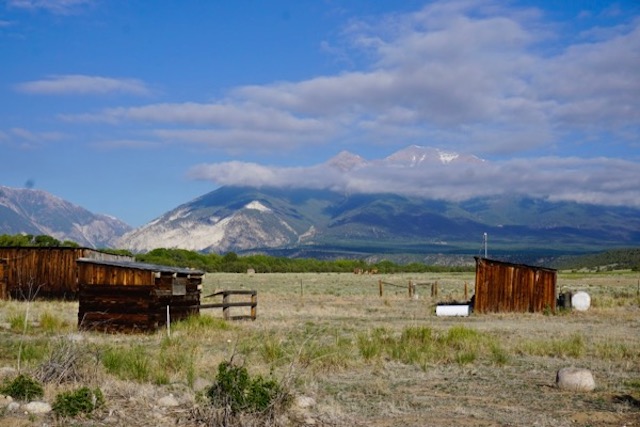
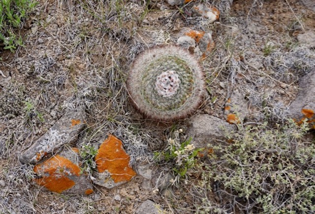
Harsh deserts w/blooming cactus – cool mountains

Parched rivers, lakes, & streams

_DSC2888

Apologies to any readers that are still checking in for being off line for this long. And I still haven’t posted promised photos from a month ago in Texas and New Mexico!

We’re now in Moab Utah, at the tail end of our southwestern National Parks phase.

Since Sedona,

_DSC2480

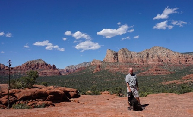
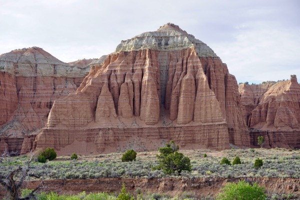
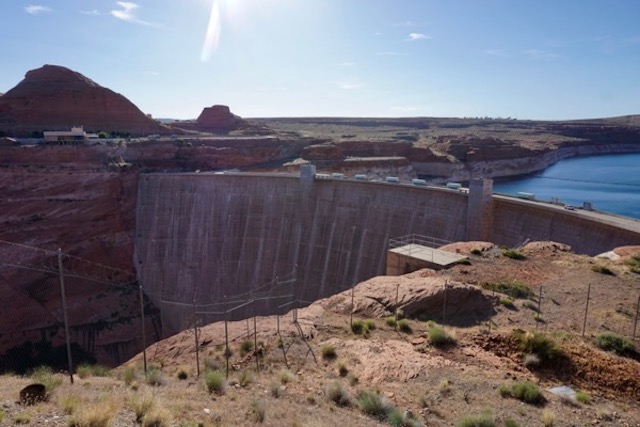
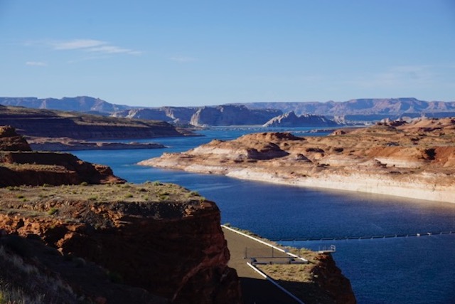
we’ve been in several national forests, Grand Canyon NP, Glen Canyon/Lake Powell NRA, Zion NP, Bryce Canyon NP, Capitol Reef NP.

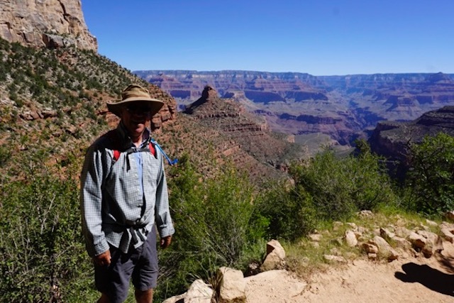
We managed a short but difficult hike to the 3 mile point under the rim at Grand Canyon (6 miles, about 2,000 feet elevation, in 90+ degree heat plus altitude!). Everyone has seen many images of Grand Canyon far better than I can shoot, so here’s my favorite:

_DSC2595

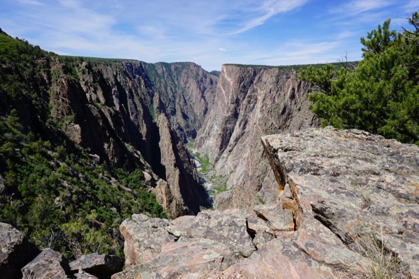
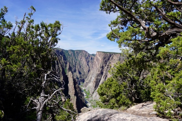
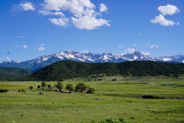
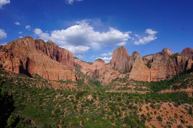
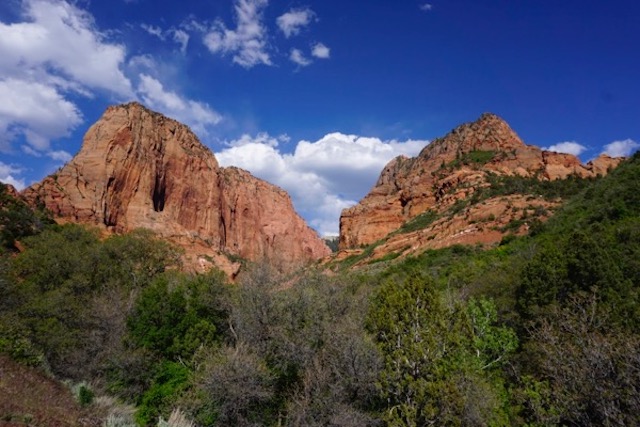
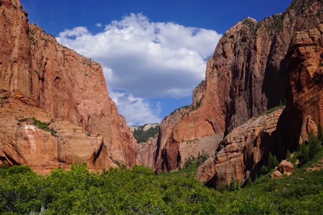
We try to avoid the crowds, which is becoming more difficult as “the summer people” begin to arrive. The best part – and probably least visited place in Zion is Kolob Canyons, take a look:

_DSC2834
_DSC2817

_DSC2822

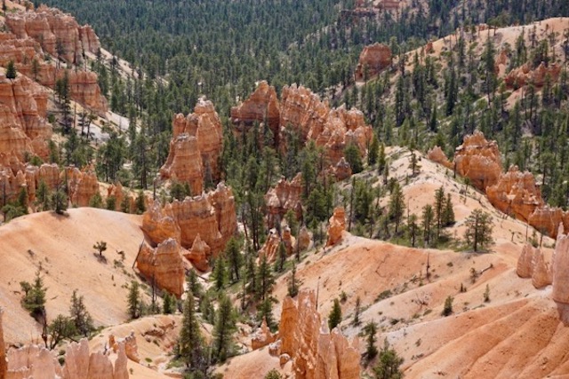
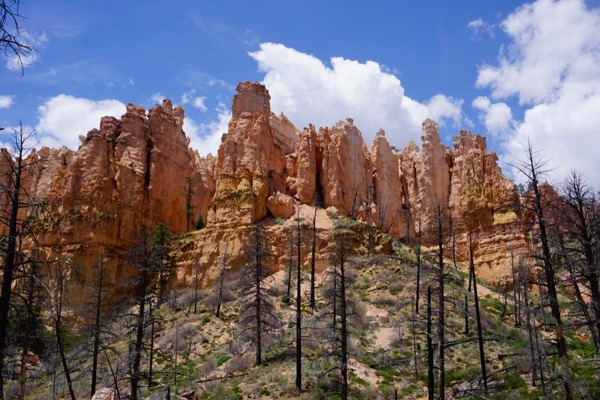
Bryce Canyon is similarly spectacular and abundantly photographed – I have more dramatic and colorful shots, but here is one of my favorite little groove of trees:

_DSC2885

In an attempt to replicate the wonderful Kolob Canyon experience, we had a scare in Capitol Reef

_DSC2932

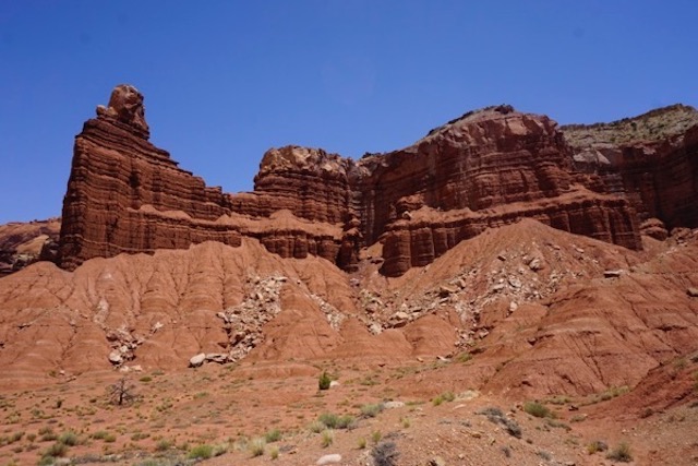
Long story short, in seeking to avoid the crowds, I misjudged a remote Forest Service road into a place called Cathedral Canyon in the northern part of the park. Got lost, got snowed on, camped at about 10,000 feet and got altitude sickness, and then had to drive over 30 miles on extremely harsh mountain and desert “roads” that inlaces looked like commercial for Jeep or Range Rover! Didn’t think the van would make it:

_DSC2953

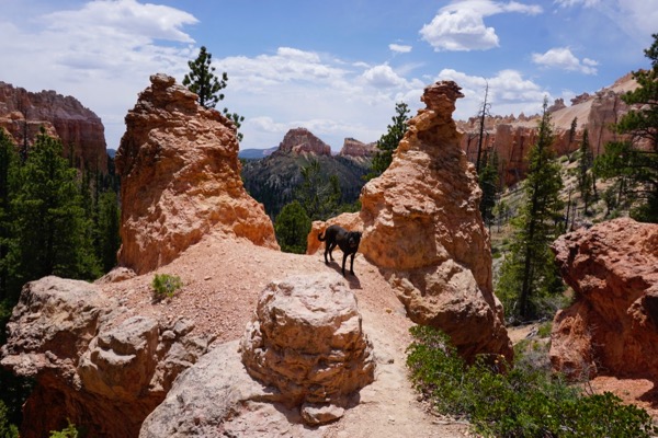
We were able to sneak a hike in a 4 mile loop trail in Bryce Canyon – Swamp Canyon trail, that’s the shot on top  – the NPS encourages folks to “Hike the Hoodoos”:

_DSC2893

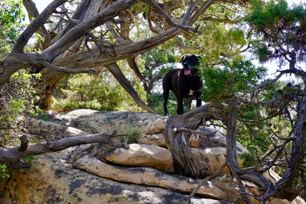
My one complaint is with the very restrictive National Park Service policy on dogs (banned on trails and shuttle buses, which severely limits our enjoyment of the parks).

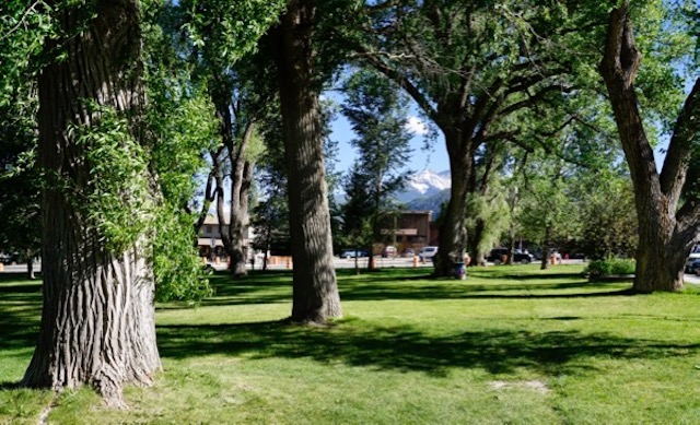
Today, we are resting in green spaces, grass and shade in a lovely Moab City park to recharge and let the weekend tourists dissipate before tackling Arches and Canyonlands NP’s.

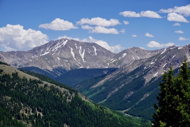
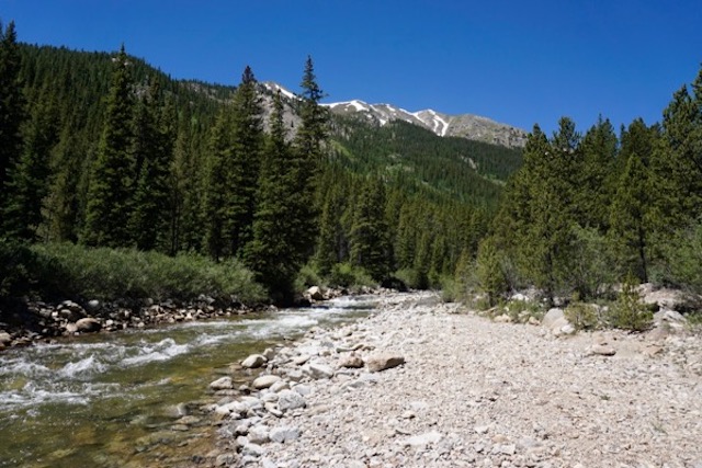
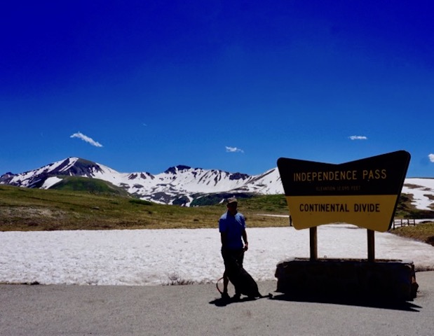
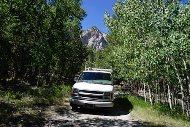
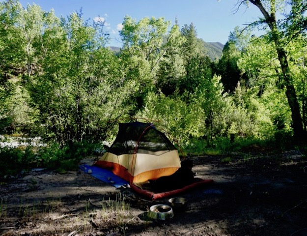
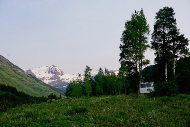
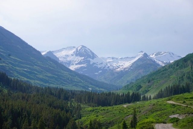
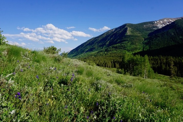
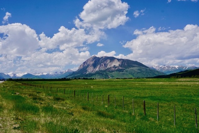
Here’s some of the scenes in between the National Parks –

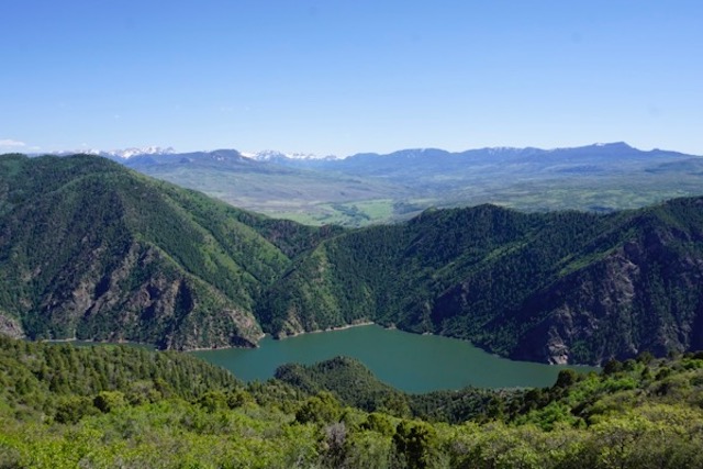
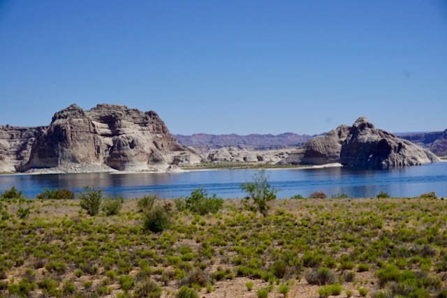
Glen Canyon – Lake Powell (yes, the Lake is being drained by proliferation of demand and over-consumption, evaporation, and climate change – but we had the beach all to ourselves!)

_DSC2672

_DSC2677

_DSC2683

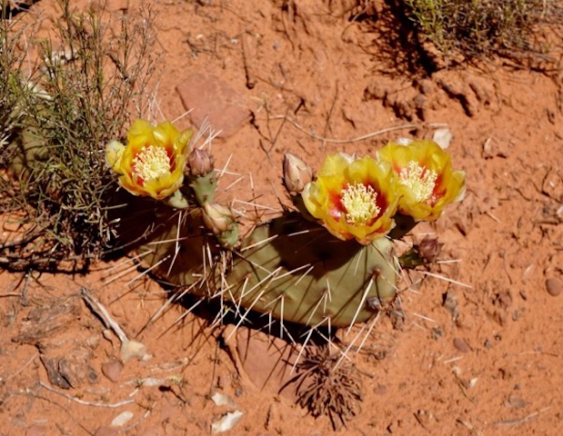
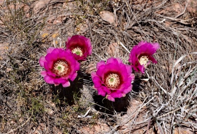
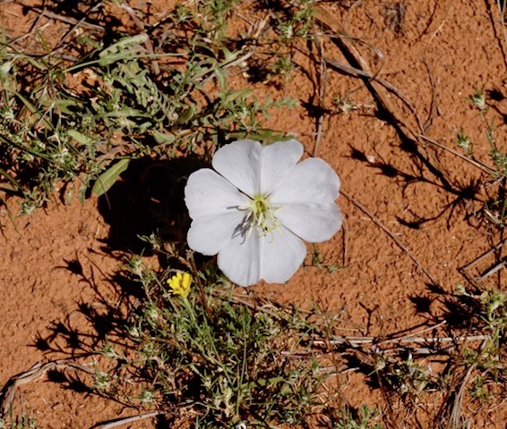
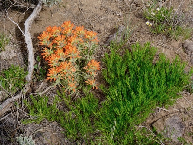
Desert in bloom (apparently the result of an unusually wet winter – don’t ask me what they are!):

_DSC2459

_DSC2471

_DSC2464

_DSC2950

_DSC2947

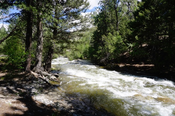
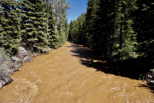
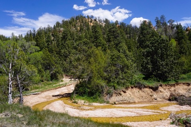
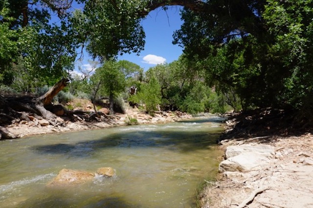
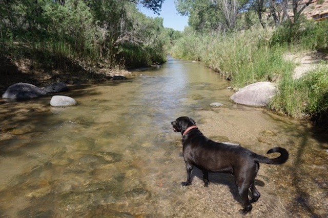
Tributary to the East Fork of the Virgin River (we dispersed camped in this spectacular canyon of a FS road for 4 nights! Not sure what causes the yellow/brown color of stream bed and there were severe erosion problems I am told was due to fire and recent storms):

_DSC2732

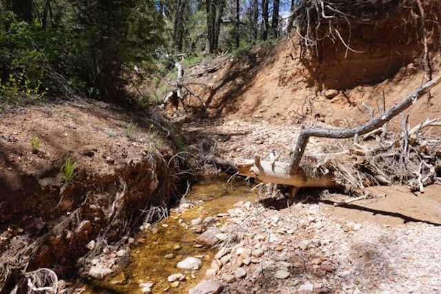
We walked the stream for about a mile above our campsite and here’s where the creek went dry:

_DSC2738

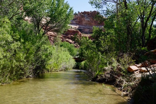
BTW, the Virgin River is channelized as if flows through Zion NP – man made engineered flow through a National Park – not much different that east coast urban rivers! Look!

_DSC2799

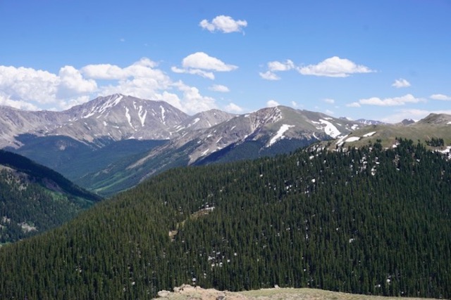
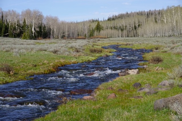
For the visitors to Zion, here’s the natural condition: snow melt in a high mountain meadow, just above Cedar Breaks National Monument:

_DSC2853

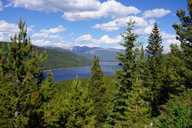
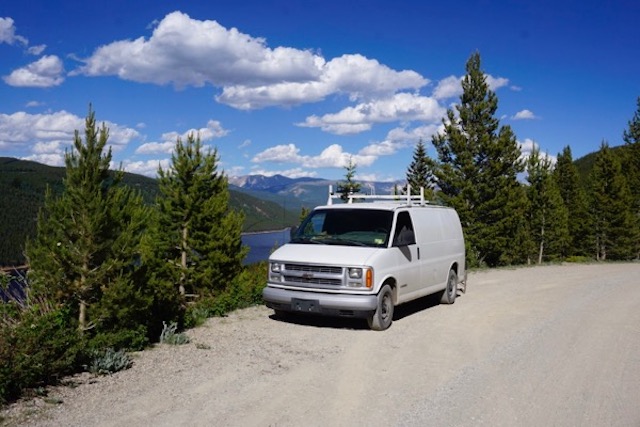
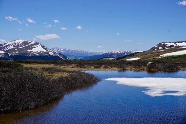
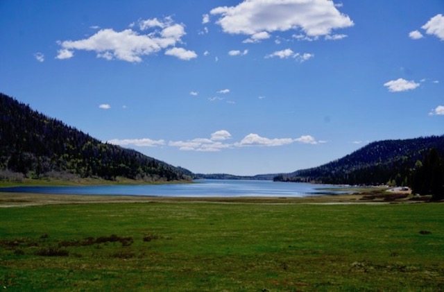
Navajo Lake, Dixie National Forest –  camped at a spectacular remote site for 4 nights. There was some snow in the mountains, but with snow melt almost complete, the lake level is very low :

_DSC2781

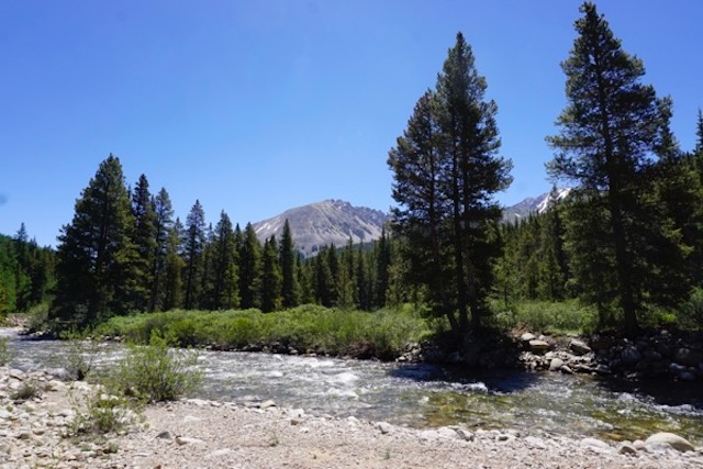
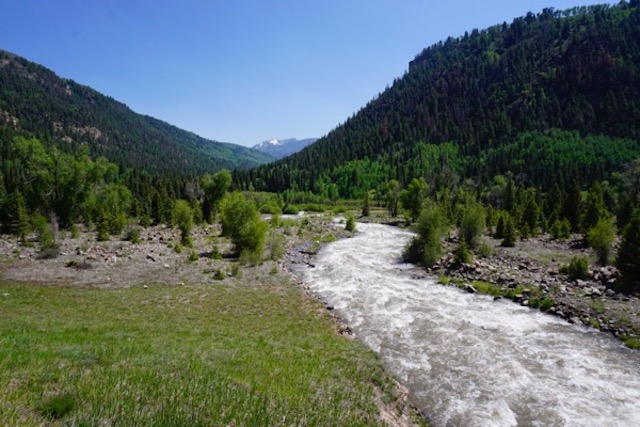
Crossing the cool and high flowing Escalante River: (while other rivers and streams in the region are dry, farmers and ranchers are irrigating for hay!):

_DSC2921

_DSC2916

And, after this lengthy update – and I still haven’t posted the Texas and New Mexico shots! –  we’ll leave you for now with this bookstore visit:

_DSC2807

Categories: Uncategorized Tags: