Take a Look At Christie DEP “Lowest Priority” Streams For Updating Flood Maps
What’s wrong with this picture?
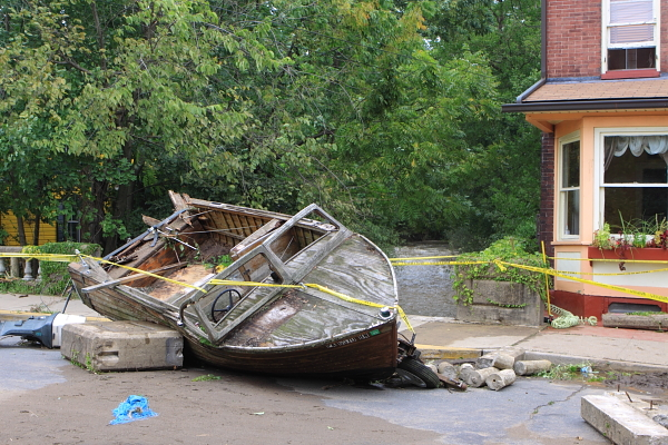
Lambertville, NJ (Hurricane Irene flooding, August 2011). Swan Creek in background.
I was just reading the DEP FY’17 budget documents to research an issue and came across this gem that I had to share.
The Office of Legislative Services (OLS) reviews each Department budget and asks a series of questions to assist legislators.
One OLS question on flooding and DEP’s response caught my eye – (see page 9)
P.L. 2015, c.270, signed into law on January 19, 2016, amended the “Flood Hazard Area Control Act” to require the department to update delineations of flood hazard areas and floodplains in the State, which would result in an expenditure increase over a 15-year time period. The legislation requires the department to update its delineations of flood hazard areas at least once every 15 years, within the limits of the funds appropriated or otherwise made available therefor, and to prioritize the preparation of updates based upon flood risk.
- Question: Has the department established a timeline for updating the delineations of flood hazard areas and floodplains in the State? If so, please describe this timeline. Have certain areas been given priority status due to their flood risk status? If so, which areas?
- Response: In New Jersey, there are approximately 5,000 miles of streams that could be delineated. Over the last 5 years, DEP and FEMA have updated mapping for the Delaware, Passaic, Hackensack, Ramapo, Wanaque and the Pompton Rivers. As part of our plan with FEMA, DEP has identified and prioritized approximately 2,000 miles of streams that need to be restudied. Priority was determined based upon the population density surrounding the flood source coupled with the level, accuracy, and age of the effective modeling. See Attachment 6 – “New Jersey State Stream By Priority.”
So, of course I had to review this stream priority system. Priorities are ranked 1 – 5, with 5 being “High Priority” and 1 being “Low Priority”.
The stream in the background that caused major flooding in Lambertville during Hurricane Irene is Swan Creek (I wrote about that, with additional photos here.)
Swan Creek is rated “Priority 1″ – the LOWEST (see page 25).
Alexauken Creek, a C1 Delaware tributary that can flood Lambertville just north of Swan Creek, also is ranked Priority 1 (lowest) – take a look at what even a small rainfall does there:
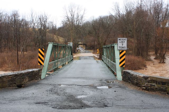
Alexauken Creek at flood stage (2009) – road is washed out – this bridge has since been replaced.
Two additional anomalies jumped out at me:
1. Pompton Lakes Blue Acres buyouts with Sandy money
Pompton Lakes was allocated $7.2 million in Sandy FEMA disaster assistance for Blue Acres buyouts of 19 homes (see Attachments #2 and #4)
Pompton Lakes is NOT located in one of the 9 impacted counties that were targeted for the Sandy recovery funds.
Why are they funded? Smells like another dirty political deal – like the one in Essex County with Joe D.
2. Bulls Island demolition
DEP claims that $50,000 was spent in Fy’15 – FY’16 on building demolition at Bulls Island – last time I was there (April 3, 2016), the buildings were still standing (see this post)
There was another $27,000 spent on underground tank removal – where?